Showing posts with label Sedona Hikes. Show all posts

Sunday, April 5, 2015

Scheurman Mountain Trail and Vista

If you are looking for an uncrowded hike during the busy tourist season in Sedona, Scheurman Mountain Trail is a good choice.

This easy to moderate trail is uphill and elevation increases quickly, but when you get to the top, you are rewarded with a great view of the valley (Cathedral Rock, Courthouse Butte, The Nuns, Ship Rock and more)

On this day, there was a haze, so the pictures do not really do the view justice! Take your time going up and spend some time at the vista enjoying the view of Red Rock Loop, and Airport Mesa.


The hike starts near Red Rock High School at the trailhead and follows the border of the high school property for a bit. Then it begins to climb. There is no 'hands and knees' climbing required, but the elevation does change quickly. 

For those with bad knees or a bad lower back, you will have to take your time on the way down the mountain, to accommodate the steep downward grade. The hike is not hard, and the path is clear, so there isn't a lot of instability, but it will take you some time to get up and back (probably about 45 minutes one way). 

When you get to the trail sign (pictured above) at the split, take a left and head up the mountain. This trail will afford you numerous opportunities for pictures at overlooks, and you can follow the rock baskets all the way to the top!


Monday, April 7, 2014

Andante and Chimney Rock Pass Trail


On a beautiful Spring day in Sedona, there is no better place to be than on a hiking trail! And, yesterday was no exception. The sky was blue, the breeze was balmy and we headed to Adante Trail to begin our hike around Chimney Rock. 

Chimney Rock is one of the iconic red rock formations in Sedona and, thanks to all of the amateur and professional photographers who have passed through this scenic paradise, Chimney Rock is well known around the world. 

One of the most interesting things about this rock formation is how it changes, depending on your perspective. This changing perspective applies to many of the beautiful monuments here (Cathedral Rock is another example of this phenomenon), but you don't have to hike or drive far to see Chimney Rock from a different vantage point. 

A quick drive up Dry Creek Road, or a leisurely hike around the base of Chimney Rock will reveal its ever-changing face, and you will discover that the 'chimney' is actually comprised of several vertical slabs of red rock, rather than the single chimney you see from some angles. 


This hike begins at Adante Trailhead (near the large green water tank) and intersects along the way with Thunder Mountain Trail and Chimney Rock Pass Trail. We took the Chimney Rock Pass trail and wandered up and down the hills, following the path around the hill atop which the chimney sits. 

This is listed as a moderate hike in the hiking books and it is that. There isn't much of an uphill challenge during the first half of the hike, but the second half contains a good portion of uphill, without much of a respite. 

After that climb, the trail takes you around to the other side and back down toward the parking lot. 


Bi-Colored Lichen on the Red Rock


Very Large (Old) Juniper
Along the way, the junipers, manzanita and spring flowers graced the landscape giving us lots of photo opportunities. 

There are some wonderful views of the valley and of Ship Rock, the top of Cathedral Rock and several other monuments. The valley is bordered by beautiful sentinels of red rock that will take your breath away!
Chimney Rock from a Distance


Views of Coffee Pot Rock, Ship Rock and More!

You will meet other hikers and perhaps some bicyclists along the path, but this trail is well worth the hike. The views are spectacular and you get to see a host of red rock formations up close and from a distance.

The Adante and Chimney Rock Pass trails comprise a hike of about 1 to 2 hours depending on how often you stop to take pictures and chat with your fellow hikers along the way!
Chimney Rock Up Close and Personal


Sunday, December 29, 2013

West Fork Trail


The West Fork trail is often listed as a favorite in popular Sedona hiking books. The popularity of the trail is well-deserved and there are numerous reasons for its popularity. Here are few of the reasons:

1.  It is not the most challenging trail in Sedona, so most people can enjoy its beauty.

2.  For much of the hike, you are following the beautiful, serene Oak Creek. 

The creek rambles along, revealing small rapids and smooth waters. You will cross it numerous times (13, to be exact) as you follow the trail, so you'll have the opportunity to really enjoy its beauty.


The Mayhew House
3.  The West Fork trail has some other treasures that may be of interest to those who want to know more about Sedona's history. 

You'll pass the Mayhew House, a dilapidated old structure that was once visited by Clark Gable, Jimmy Stewart and others. 

4.  The trail winds through meadows, Ponderosa Pine and red and white cliffs. 

This beautiful canyon was the inspiration of Zane Grey's 'Call of the Canyon' and, if you take the time to traverse the 3.3 mile hike, you will see why. 


We took this hike on Christmas Day. The cool air and shade of the tree groves and the overhanging cliffs would be a treat during the summer. 


Much of the trail is shaded by trees and cliffs and the recent snowfall made the trails icy and the hike a bit cold, but it was worth the effort. 

The canyon is 12 miles long, but the official hike is a little over 3 miles and, in good weather when the trails are in good shape, it should take you about 90 minutes to get to the end of the trail. 


Because of the icy conditions, and the late hour, we did not complete the hike, but we will certainly do so on another day when the weather is better. 


Tuesday, October 8, 2013

Bell Rock

Bell Rock


Bell Rock is one of the most famous red rock formations in Sedona and a favorite among tourists. 


It is easy to see from the Village of Oak Creek and you can get great pictures from the Bell Rock Vista parking lot and the Courthouse Butte Lot. 

The changes made to Route 179 several years ago required that Forest Service create new trail heads for the surrounding trails. 

If you have an old hiking book, you will need to get a new map or hiking book before you set out on your hike. Several new trails have been added. 


Courthouse
Some will take you around the bottom of the formation and some will take you up onto the formation. This is one of the most popular spots in Sedona, so you can expect to share the trails with a lot of other hikers (no matter the season).

Stay on the trails and watch for the wire baskets filled with red rock. They will guide you safely to your destination and ensure that no damage is done to the indigenous plants or to the rock formation.

Route 179 and the Valley
Heading Up Bell Rock
The hike to the first 'apron' or flat level of Bell Rock is not very difficult. 


From there you can see the valley, Chapel Rock, and the other main monuments in the vicinity (Thunder Mountain, Cathedral Rock, Courthouse). 

You may be tempted to stay in the parking lot, but if you are willing to make the short trip up to the first apron, we guarantee you won't be disappointed. 

You can sit in the sun, look at the red rock view, take pictures and enjoy a brief moment of serenity in the the paradise that is Sedona.

Chapel Rock and the View from the Top (Nearly)
If you are more adventurous, you can make the climb up toward the top and experience an amazing view of the valley and the hikers below you.  

As with all hikes in AZ, be sure to bring plenty of water, sunscreen and a hat. 


Allow yourself enough time to hike to your destination and return before the sun sets. 


Courthouse as seen from Bell Rock


Sunday, September 22, 2013

Medicine Caves

Approaching Medicine Caves


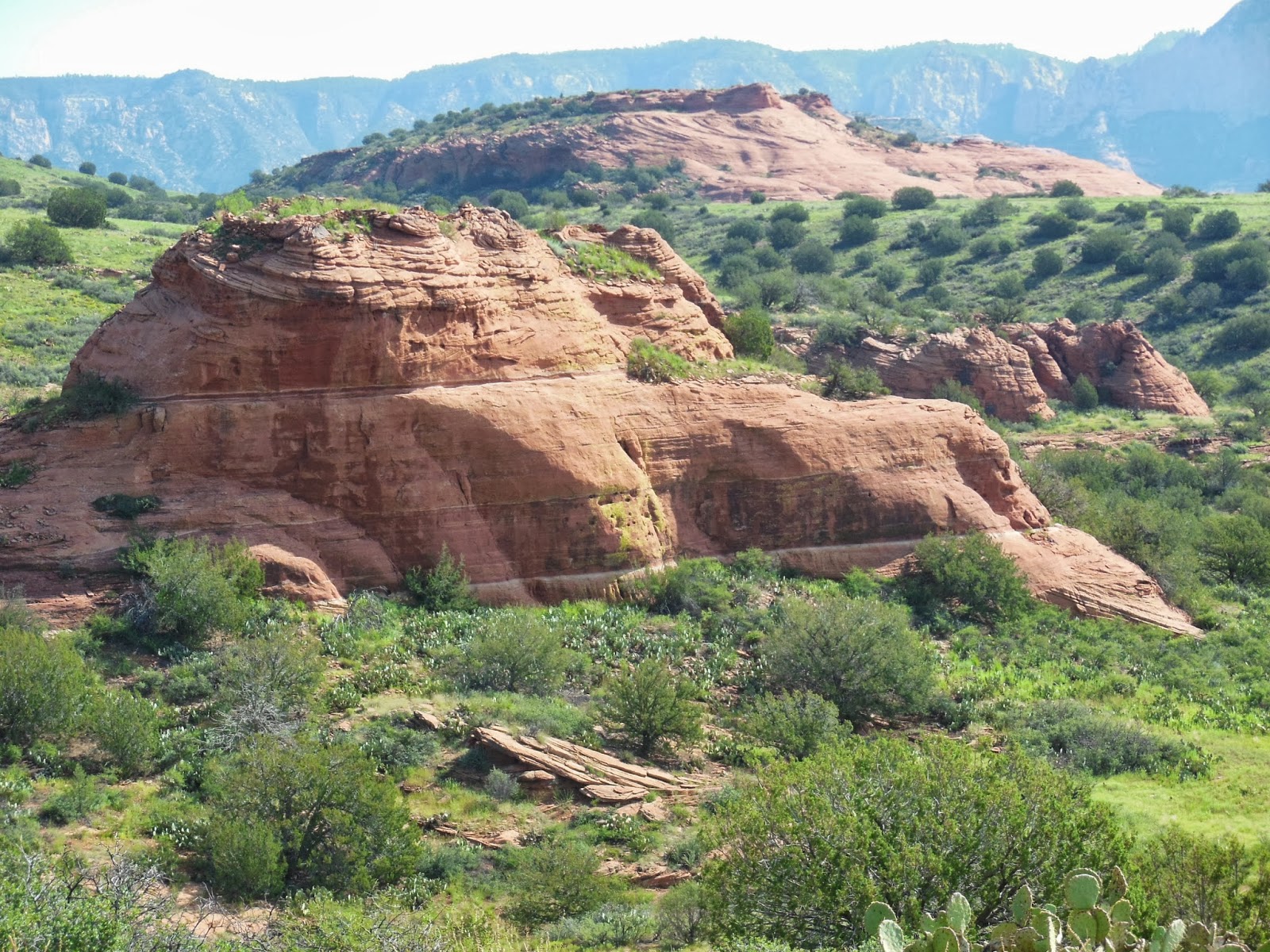
Medicine Caves is an area that is little known among Sedona visitors. It isn't in the hiking books and it is somewhat remote. 


It is nestled in a valley that is bounded on one side by Casner Mountain and on the other by the ridge that leads to Robbers Roost (Shaman's Cave). The valley is dotted with smaller outcroppings of red rock, each of which has cave-like areas at its base.

Medicine Caves (foreground) Robbers  Roost (background)
The largest of these outcroppings has two levels of caves (which are actually indentations in the rock; some with trees growing directly in front of the crack. 


If you are among the many who visit Sedona for its spiritual and metaphysical energy, you'll find plenty of small 'shelves' and pockets in which to charge your crystals, fetishes, totems or sacred artifacts. 
A View of One of the Caves


The top level of the central red rock outcropping affords some great views of the little valley in which it resides, and the valleys and land beyond. The trunk of the juniper tree growing on the apron at the front of this rock displays the classic 'energetic twist' often observed in Sedona where a particular spot is flowing with earth energy. 


Charging Stones in the Healing Caves
There is a history of tribal healing in this valley, with each of the red rock outcroppings and each of the 'caves' in the main rock visited in a specific sequence and/or for a specific ailment or dysfunction. 

Take your time and sit at each of the openings in the rock on both the lower and the upper level of the main outcropping and, hopefully, you will have your own healing experience. 


We did not have the time to visit the other red rock cave outcroppings but we look forward to a return visit.


Navajo Tapestry in Main Energetic Rift of Central Medicine Cave


Saturday, April 27, 2013

Marg's Draw

Thunder Mountain


Marg's Draw is a great hike. It's not too short and it's not too long (whether you do the north or the south fork, you will travel a little less than 3 miles round trip). 


There is an interesting story associated with this trail. Marg was a mule, owned by the first recorded Sedona settler, Abraham James. When Marg didn't want to work, she would follow this path up into the evergreen near the red rocks and hide from her master. Hence, the name: Marg's draw. 


Views of Uptown and the Red Rocks


Like Marg, I was drawn to this trail. 

The first part of the trail is the most challenging with small and medium sized rocks underfoot. The hike is listed in most hiking books as 'moderate' but much of the trail is pretty easy going. 

Those with bad knees or lower back or ankle issues will want to be careful on the uneven footing at the beginning of the trail. 


Large rocks form stairs and require a bit of maneuvering as you go uphill. Once you are past this section, the trail is easier. It flattens out and winds through evergreens, yucca, agave and manzanita. 


Late April is a beautiful time to hike this trail.  You'll find delicate white and yellow flowers and small bushes with pretty purple foliage. 

The trail winds through beautiful red rock areas with views of uptown Sedona. Although it is relatively close to town, the foliage covers much of the residential and commercial scenery so you can enjoy the natural environs. 


Cathedral Rock in the Distance


At the trail split, we took a left and headed toward Schnebly Hill Rd. 

If you bear right at this point, the trail will take you toward Broken Arrow (a very popular hike among Sedona visitors and jeep tour companies). 


Along the way you'll be treated to views of Chimney Rock, Cathedral Rock, Thunder Mountain (the ubiquitous monument that seems to be in view from every trail), and close up views of Snoopy Rock in the bargain!

Snoopy Rock


Follow this trail until you reach Schnebly Hill Rd. If you cross this road and continue on, you will intersect with Huckaby Trail. 


Marg's Draw is a favorite!