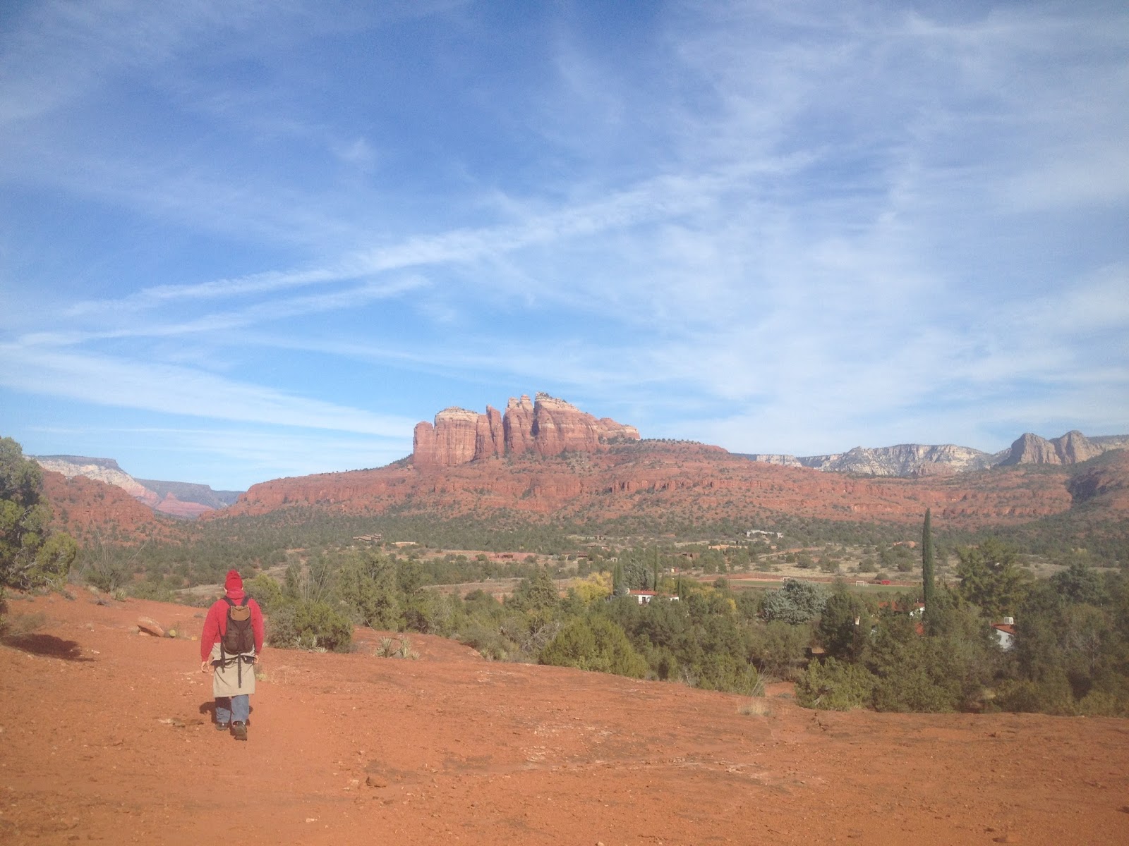
Tuesday, May 16, 2017

Walnut Canyon

OK, OK, so it isn't technically in Sedona but it is nearly within earshot!  This is a hike we haven't done for 25  years so we decided to head on over to Walnut Canyon and do it again.

The Visitor Center provides some preliminary information and a video to get you oriented. Then you start your descent into the canyon to view the cliff dwellings. Island Trail is not for those with bad knees or a bad lower back. There are a lot of stairs leading down and, of course, you have to get back out again, so beware!

If you have someone in your party who can't make the trip down, you can use the Rim Trail which is suitable for those in wheelchairs and those with strollers.


Walnut Canyon was inhabited from about 600 to 1400 A.D. and this thriving community used this sparse land to grow food and raise families. These cliff dwellings were home to hundreds of people.


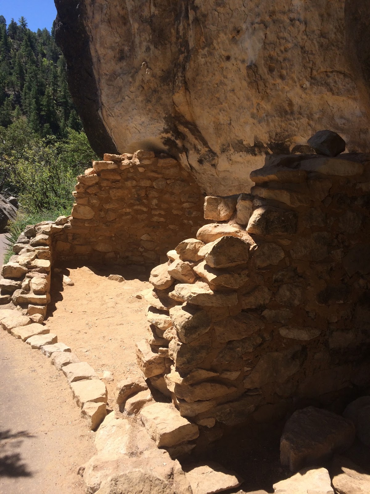


The day was beautiful but windy and the local spring blooms were beautiful. The dwellings are still miraculously intact although looting in the 1800s and the early 1900s took its toll. During that time, some walls were knocked down and many artifacts were taken from this site. Its designation as a National Monument now protects it for generations to come. 

If you close your eyes and sit quietly, you can imagine the echoes of families and children calling across the canyon!

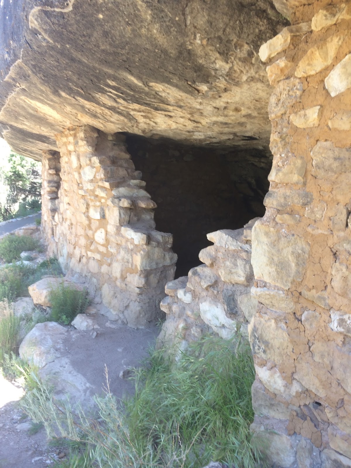


The dwellings on the opposite side of the canyon are not accessible but when one considers the placement of these dwellings and the challenge of getting up to the rim for farming and other activities, it is truly a testament to the will and determination of the people to think that they carried on everyday life here for so long. 


If you want to visit Walnut Canyon, plan on spending 3-4 hours at the site so you have plenty of time to see the Visitor Center and to take the trek down and up the canyon. It is well worth the time. Bring plenty of water, good hiking shoes, a hat and some sunscreen. 


Monday, January 30, 2017

Fay Canyon

This is a very popular hike for tourists and residents alike and with good reason. It is a very reasonable length (1 mile in) and there is no real climbing or elevation change.


Park across the street in the lot and cross Dry Creek Road to the trail head, then meander along the dry creek bed and follow the canyon back to the end. It is an easy hike and one that is shaded around noon with some sun on the trail in the afternoon.


At the end of the maintained trail, you can choose to turn back or you can dare to scramble up the red rocks and get a better view at the top. It is rough going but you will be rewarded with some beautiful pictures at the top.


There is an archaeological site at the top so be sure to pay attention to the signage at the end of the maintained trail.

Do not move or throw rocks. Do not carve or paint your name on the rocks. Do not disturb the landscape. Leave the beauty and the rich heritage and history for those who come after you! 

Friday, November 25, 2016

Twin Pillars/Turkey Creek - Village of Oak Creek

We decided to hike on Thanksgiving Day. While we did not follow the Twin Pillars or Turkey Creek Trails exactly, we did cross over and use parts of each trail.


We climbed toward the saddle of one of the red rock formations and crossed over onto the other side to circle the formation and head back in the general direction of Verde Valley School Road. 


There are lots of dry washes and slides in the area and some beautiful views of Cathedral Rock and other surrounding formations. 

These trails are right off Verde Valley School Road. Depending on the route you take and which direction you take, you can enjoy a 1-2 mile hike and be back to the parking lot in time for lunch. 

For the most part, these trails are easy, with some moderately difficult sections along the way. The trails are not among the busiest or most popular in Sedona so if you like to have some peace and quiet, these trails will suit you just fine!


Friday, November 27, 2015

Sugarloaf Loop Trail

Coffee Pot Rock
We took a Thanksgiving morning hike to this great little spot. The Sugarloaf trail intersects with Thunder Mountain (Capitol Butte) trail and with Teacup trail and offers great views of Thunder Mountain and Chimney Rock and on the back side the valley opens up to reveal Ship Rock, Coffee Pot and other Sedona treasures. 

Thunder Mountain
The hike is moderately difficult with a bit of up and down at the beginning and then a moderate climb up the spine of Sugarloaf to the top. The hike is about one mile round trip, and it is well worth the effort.

Chimney Rock
Once you get to the top of Sugar Loaf you are met with a 360 view of the valley and surrounding monuments. In the distance, you can see Courthouse Butte, Airport Mesa, and even the top of Bell Rock peeking at you from the Village of Oak Creek!

The trail is well-traveled during tourist season so you are likely to greet other hikers along the way. Sugar Loaf offers some great views and a panoramic perspective of Sedona and its little communities and uptown area, and it is a hop, skip and a jump from town, so you don't have to travel far!

Sunday, April 5, 2015

Scheurman Mountain Trail and Vista

If you are looking for an uncrowded hike during the busy tourist season in Sedona, Scheurman Mountain Trail is a good choice.

This easy to moderate trail is uphill and elevation increases quickly, but when you get to the top, you are rewarded with a great view of the valley (Cathedral Rock, Courthouse Butte, The Nuns, Ship Rock and more)

On this day, there was a haze, so the pictures do not really do the view justice! Take your time going up and spend some time at the vista enjoying the view of Red Rock Loop, and Airport Mesa.


The hike starts near Red Rock High School at the trailhead and follows the border of the high school property for a bit. Then it begins to climb. There is no 'hands and knees' climbing required, but the elevation does change quickly. 

For those with bad knees or a bad lower back, you will have to take your time on the way down the mountain, to accommodate the steep downward grade. The hike is not hard, and the path is clear, so there isn't a lot of instability, but it will take you some time to get up and back (probably about 45 minutes one way). 

When you get to the trail sign (pictured above) at the split, take a left and head up the mountain. This trail will afford you numerous opportunities for pictures at overlooks, and you can follow the rock baskets all the way to the top!


Sunday, June 15, 2014

Sedona Hiker Road Trip: Monument Valley, Cedar Mesa, Natural Bridges, Canyonlands and Arches


While Arizona, and Sedona in particular offers numerous wonders to explore, Sedona Hiker is not immune to the beauty of other locales. On a recent trip to Utah, I sampled some of the most beautiful locations in the state. 

We did not include Bryce and Zion in this trip because we had already been there, but we will certainly go back again. 

If you have not yet visited these wonders of nature, you must do so!


This trip included Monument Valley, Cedar Mesa, Natural Bridges, Canyonlands and Arches parks. 

We started our trip in Monument Valley, driving the loop to take in the sights and marvel at the iconic monuments that served as a backdrop to some of America's most famous Western movies. 

Monument Valley


Onward toward Mexican Hat, and then to Cedar Mesa and Natural Bridges. 

The next day we headed to Canyonlands and took the rim hike to enjoy the beautiful canyon below us. 

Then it was on to Arches. 

A memorable trip with lots of beautiful landscape to see!
Natural Bridges
Canyonlands

Mesa Arch at Canyonlands

Arches

Arches

Arches

Arches

Arches

Mexican Hat

Monday, April 7, 2014

Andante and Chimney Rock Pass Trail


On a beautiful Spring day in Sedona, there is no better place to be than on a hiking trail! And, yesterday was no exception. The sky was blue, the breeze was balmy and we headed to Adante Trail to begin our hike around Chimney Rock. 

Chimney Rock is one of the iconic red rock formations in Sedona and, thanks to all of the amateur and professional photographers who have passed through this scenic paradise, Chimney Rock is well known around the world. 

One of the most interesting things about this rock formation is how it changes, depending on your perspective. This changing perspective applies to many of the beautiful monuments here (Cathedral Rock is another example of this phenomenon), but you don't have to hike or drive far to see Chimney Rock from a different vantage point. 

A quick drive up Dry Creek Road, or a leisurely hike around the base of Chimney Rock will reveal its ever-changing face, and you will discover that the 'chimney' is actually comprised of several vertical slabs of red rock, rather than the single chimney you see from some angles. 


This hike begins at Adante Trailhead (near the large green water tank) and intersects along the way with Thunder Mountain Trail and Chimney Rock Pass Trail. We took the Chimney Rock Pass trail and wandered up and down the hills, following the path around the hill atop which the chimney sits. 

This is listed as a moderate hike in the hiking books and it is that. There isn't much of an uphill challenge during the first half of the hike, but the second half contains a good portion of uphill, without much of a respite. 

After that climb, the trail takes you around to the other side and back down toward the parking lot. 


Bi-Colored Lichen on the Red Rock


Very Large (Old) Juniper
Along the way, the junipers, manzanita and spring flowers graced the landscape giving us lots of photo opportunities. 

There are some wonderful views of the valley and of Ship Rock, the top of Cathedral Rock and several other monuments. The valley is bordered by beautiful sentinels of red rock that will take your breath away!
Chimney Rock from a Distance


Views of Coffee Pot Rock, Ship Rock and More!

You will meet other hikers and perhaps some bicyclists along the path, but this trail is well worth the hike. The views are spectacular and you get to see a host of red rock formations up close and from a distance.

The Adante and Chimney Rock Pass trails comprise a hike of about 1 to 2 hours depending on how often you stop to take pictures and chat with your fellow hikers along the way!
Chimney Rock Up Close and Personal