Thursday, January 9, 2014

West Clear Creek


The West Clear Creek hike is not the most popular hike in Sedona, nor is it the most breathtaking. But, for those who want an easy hike without climbing, this is a good choice. 

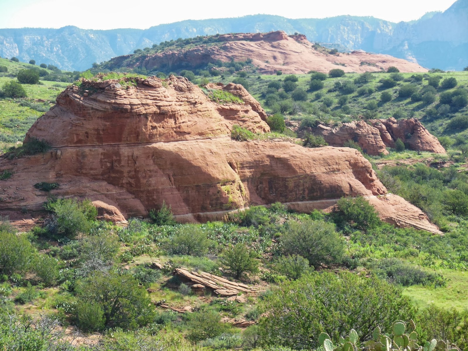
The West Clear Creek trail rambles along the creek and through meadows, revealing some beautiful tall mountains and a wall of red rock. 


A peek at some red rocks


The remains of an old field stone house stand in a meadow, surrounded by scrub and some small trees. 


If the creek is not running high, you can cross it at the end of the trail and follow along the creek for another mile or so. 


Eventually, you will reach a point where the land on this side of the creek rises and, if you choose to continue the hike beyond this point, beware! 

This is not an established trail and it will take you up another 2000 feet, so it is not for the feint of heart. 


If you stick to the established trail, the West Clear Creek hike will take you about an hour.


If you get a late start, you will need a jacket on the way back. Once the sun dips behind the high mountains on the opposite side of the creek, you will be cold!

Beautiful old Cottonwood tree
The nicest surprise we had on this hike was something we saw shortly after we left the parking lot at the trail head. There is one gigantic Cottonwood tree standing guard over the path. There are also some very large, old Sycamore trees gracing the path.


A view of the creek


If you are in the mood for a serene hike and you don't have all day to complete the journey, you'll like West Clear Creek a lot. 


The established trail is a little over a mile long and it makes for an easy and enjoyable day. 


There aren't a lot of tour planes or helicopters overhead, so you can enjoy the peace and quiet of nature. 

Oh! One more thing. We finished our hike and drove out of the parking area, and up the winding road. On our way out, we were lucky enough to see two magnificent eagles circling overhead. 

They landed on the top of the hill above us and we thought they were probably going back to their aerie. 
A little cave along the creek

A nice surprise at the end of a peaceful New Year's Day hike!

Sunday, December 29, 2013

West Fork Trail


The West Fork trail is often listed as a favorite in popular Sedona hiking books. The popularity of the trail is well-deserved and there are numerous reasons for its popularity. Here are few of the reasons:

1.  It is not the most challenging trail in Sedona, so most people can enjoy its beauty.

2.  For much of the hike, you are following the beautiful, serene Oak Creek. 

The creek rambles along, revealing small rapids and smooth waters. You will cross it numerous times (13, to be exact) as you follow the trail, so you'll have the opportunity to really enjoy its beauty.


The Mayhew House
3.  The West Fork trail has some other treasures that may be of interest to those who want to know more about Sedona's history. 

You'll pass the Mayhew House, a dilapidated old structure that was once visited by Clark Gable, Jimmy Stewart and others. 

4.  The trail winds through meadows, Ponderosa Pine and red and white cliffs. 

This beautiful canyon was the inspiration of Zane Grey's 'Call of the Canyon' and, if you take the time to traverse the 3.3 mile hike, you will see why. 


We took this hike on Christmas Day. The cool air and shade of the tree groves and the overhanging cliffs would be a treat during the summer. 


Much of the trail is shaded by trees and cliffs and the recent snowfall made the trails icy and the hike a bit cold, but it was worth the effort. 

The canyon is 12 miles long, but the official hike is a little over 3 miles and, in good weather when the trails are in good shape, it should take you about 90 minutes to get to the end of the trail. 


Because of the icy conditions, and the late hour, we did not complete the hike, but we will certainly do so on another day when the weather is better. 


Tuesday, October 8, 2013

Bell Rock

Bell Rock


Bell Rock is one of the most famous red rock formations in Sedona and a favorite among tourists. 


It is easy to see from the Village of Oak Creek and you can get great pictures from the Bell Rock Vista parking lot and the Courthouse Butte Lot. 

The changes made to Route 179 several years ago required that Forest Service create new trail heads for the surrounding trails. 

If you have an old hiking book, you will need to get a new map or hiking book before you set out on your hike. Several new trails have been added. 


Courthouse
Some will take you around the bottom of the formation and some will take you up onto the formation. This is one of the most popular spots in Sedona, so you can expect to share the trails with a lot of other hikers (no matter the season).

Stay on the trails and watch for the wire baskets filled with red rock. They will guide you safely to your destination and ensure that no damage is done to the indigenous plants or to the rock formation.

Route 179 and the Valley
Heading Up Bell Rock
The hike to the first 'apron' or flat level of Bell Rock is not very difficult. 


From there you can see the valley, Chapel Rock, and the other main monuments in the vicinity (Thunder Mountain, Cathedral Rock, Courthouse). 

You may be tempted to stay in the parking lot, but if you are willing to make the short trip up to the first apron, we guarantee you won't be disappointed. 

You can sit in the sun, look at the red rock view, take pictures and enjoy a brief moment of serenity in the the paradise that is Sedona.

Chapel Rock and the View from the Top (Nearly)
If you are more adventurous, you can make the climb up toward the top and experience an amazing view of the valley and the hikers below you.  

As with all hikes in AZ, be sure to bring plenty of water, sunscreen and a hat. 


Allow yourself enough time to hike to your destination and return before the sun sets. 


Courthouse as seen from Bell Rock


Robbers' Roost (Shaman's Cave)

View from the Cave at Robbers' Roost


This spot isn't far from our home in Sedona. It isn't a long or difficult hike and the view and cave are spectacular...so it is a favorite. 

The trail-head is at the end of a rather bumpy, long road so a high clearance vehicle is definitely required. 


The spot is popular with tourists and locals alike, so you will probably have to share the view with others. The trail-head takes you down into a small valley and then up a hill that winds around to the left side of the monument. 

View of the Valley Below the Cave at Robbers' Roost


When you get to the back side of the monument, you will have to cross the apron of the red rock. 

This crossing may be a bit daunting for those with poor balance or those who are afraid of heights. 


Stick with it and just take your time. When you get to the cave, you will be glad you were persistent!


Inside the Cave
The front and inner 'walls' of the cave have been re-built with red rock to recreate the 'rooms' and the protective ledge at the front of the cave. 


Natural Window
The most impressive feature of the cave is not man-made. There is a natural window on one side of the cave. This window looks out into the valley beyond and allows one to see anyone who might approach the cave through the valley (hence the name, 'Robbers' Roost').

Before it was used by settlers, thieves and others, the cave was used by tribal Shamans for ceremony and healing. 

View of the Red Rocks from Inside the Cave
You can easily climb out the 'window' and stand on the far apron of the red rock formation to view the valleys below and beyond. 

Take the time to drive out to this remote location and make the hike around the monument to visit this natural cave. 

View of the Valley from the Natural Window
It is worth the trip and it will definitely be one of your favorite Sedona locations.


Sunday, September 22, 2013

Medicine Caves

Approaching Medicine Caves


Medicine Caves is an area that is little known among Sedona visitors. It isn't in the hiking books and it is somewhat remote. 


It is nestled in a valley that is bounded on one side by Casner Mountain and on the other by the ridge that leads to Robbers Roost (Shaman's Cave). The valley is dotted with smaller outcroppings of red rock, each of which has cave-like areas at its base.

Medicine Caves (foreground) Robbers  Roost (background)
The largest of these outcroppings has two levels of caves (which are actually indentations in the rock; some with trees growing directly in front of the crack. 


If you are among the many who visit Sedona for its spiritual and metaphysical energy, you'll find plenty of small 'shelves' and pockets in which to charge your crystals, fetishes, totems or sacred artifacts. 
A View of One of the Caves


The top level of the central red rock outcropping affords some great views of the little valley in which it resides, and the valleys and land beyond. The trunk of the juniper tree growing on the apron at the front of this rock displays the classic 'energetic twist' often observed in Sedona where a particular spot is flowing with earth energy. 


Charging Stones in the Healing Caves
There is a history of tribal healing in this valley, with each of the red rock outcroppings and each of the 'caves' in the main rock visited in a specific sequence and/or for a specific ailment or dysfunction. 

Take your time and sit at each of the openings in the rock on both the lower and the upper level of the main outcropping and, hopefully, you will have your own healing experience. 


We did not have the time to visit the other red rock cave outcroppings but we look forward to a return visit.


Navajo Tapestry in Main Energetic Rift of Central Medicine Cave


Tuesday, May 14, 2013

Sedona Hiker Does Antelope Canyon, Horseshoe Bend and Lake Powell

Horseshoe Bend - Colorado River
The Sedona Hiker is focused on hikes in Sedona, AZ, but I am going to make an exception to share our recent trip to Page, AZ.


With all of that beauty stored in our cameras, it seemed right to share some of it with you!  

If you haven't visited this part of Arizona, you really must! 

Page is within driving distance of Utah and its numerous parks (Bryce, Zion, Arches, Canyonlands, and more). 

It is also within driving distance of Monument Valley (made famous as the backdrop for many Westerns). 

Lake Powell and the surrounding landscape also appear in numerous movies. But, for those of us who love nature, there's nothing like seeing it for yourself!

We arrived in Page in the afternoon and stayed that night and the following night. In that time we were able to see some beautiful sights.

  • The Horseshoe Bend Overlook on the Colorado River
  • Sunset over Lake Powell and the surrounding area
  • Boat trip to explore beautiful Lake Powell
  • Photography Tour of Upper Antelope Canyon

Rock Formation at Horseshoe Bend Overlook


Page, AZ is an interesting town. The town originally housed the people who built the Lake Powell Dam in the nineteen fifties and sixties. 

Today, it is a tourist town that is surrounded by the Navajo Nation.


80% of the children in the local high school are Navajo and many of the tourist services are provided by Navajo who live on the reservation. 

The dam at Lake Powell supplies power to surrounding states, but not to the Navajo Nation. 

The Navajo Generating Station stands tall over the Page landscape. It is a coal-fired power plant that provides power to surrounding states and localities but NOT to the reservation. 

Waiting for Sunset


The Wahweap Marina offers private boat rentals and tours of the lake. 

There are numerous chain hotels in the area and a beautiful resort on the water. 

We stayed in the old housing district, which is comprised of buildings that housed dam workers. These buildings have been modestly updated to serve as motels.

The rooms are simple but functional and provide efficiency accommodations with kitchens, linens, dishes, etc. 
Navajo Tapestry Along Lake Powell

We took a short boat tour of Lake Powell and saw a sampling of the surrounding rock formations that were once the walls of Glen Canyon, named by the explorer, John Wesley Powell.

If you have the time and the inclination, you can rent a boat and explore the many side channels and tributaries around the lake, and pull your boat up onto an outcropping or small beach to enjoy the sun and the view.

The surface of the lake is 350 feet above the floor of the original canyon.


Far and away the most arresting sights in this wonderful area are hidden away in slot canyons.

We took the morning photography tour in Upper Antelope Canyon. 
Entrance to Upper Antelope Canyon


These tours are only available through tour groups because the canyon is on tribal land. Your tour price will include a permit fee to gain access to tribal land.

The hike into Upper Antelope Canyon is all at ground level so anyone can enjoy the sights. 

As long as you are able to walk on your own, you can participate in this trip. 

There were several small children and infants who took the tour, so there doesn't seem to be any restriction on age. 


The upper canyon photography tour doesn't require climbing or challenging physical conditions BUT, it is a bit chaotic. 

In order to get the best pictures, you'll want to listen carefully to the guide when he/she provides instructions about camera settings. 

The light appears and fades quickly inside the canyon and you will miss that perfect shot if you don't pay attention. 

If you want to get the most out of the visit, move quickly when the guide tells you to HURRY. 


The light beams appear at a specific time and they shoot into the canyon like laser beams! 

The native guides will move you back and forth throughout the canyon, timing the light beams with exact precision. 

They will throw sand up into the light beam to better highlight the rays so you can get good pictures. They know their stuff!


Because of the increase in international travel marketing and all of the beautiful pictures of Antelope Canyon on the internet, the canyons are now crowded with visitors. 

We were there in May (summer is busier) and the canyon was filled with people. We heard accents from all over the world!

Light Beams in Upper Antelope Canyon


Every group has a guide and each group will maneuver around the other groups to be sure that every visitor sees what they came to see. 

You'll also pass tours that are not focused on photography, and while they are not wielding cameras, you will have to deal with the additional crowding. 


In some areas, the slot canyon is only wide enough for two people to pass, so it can be a bit tight but somehow the Navajo guides get it done - moving the groups back and forth with precise timing. 

We had hoped to hike Lower Antelope Canyon the following day but we weren't able to go. 

Lower Antelope Canyon is also tribal land, and your tour price will include a permit fee. But, here you must pay by traveler's cheque or cash.


This hike is also on flat ground. We were told that it is more strenuous than the upper canyon, because you have to climb down ladders that are bolted to the cliff face in order to get to the bottom. 

Once there, the hike is supposed to be an easy walk, but we can't confirm this because we weren't able to go.

Our sources also said that Lower Antelope Canyon is wider on top so you won't get the same light beams and stunning array of shadows, but they say it is very beautiful and well worth your time. We hope to return to take this hike at a later date.

The trip to Page and the surrounding area is rewarding, and you will make some great memories there, even if you aren't an avid photographer. 


Saturday, April 27, 2013

Marg's Draw

Thunder Mountain


Marg's Draw is a great hike. It's not too short and it's not too long (whether you do the north or the south fork, you will travel a little less than 3 miles round trip). 


There is an interesting story associated with this trail. Marg was a mule, owned by the first recorded Sedona settler, Abraham James. When Marg didn't want to work, she would follow this path up into the evergreen near the red rocks and hide from her master. Hence, the name: Marg's draw. 


Views of Uptown and the Red Rocks


Like Marg, I was drawn to this trail. 

The first part of the trail is the most challenging with small and medium sized rocks underfoot. The hike is listed in most hiking books as 'moderate' but much of the trail is pretty easy going. 

Those with bad knees or lower back or ankle issues will want to be careful on the uneven footing at the beginning of the trail. 


Large rocks form stairs and require a bit of maneuvering as you go uphill. Once you are past this section, the trail is easier. It flattens out and winds through evergreens, yucca, agave and manzanita. 


Late April is a beautiful time to hike this trail.  You'll find delicate white and yellow flowers and small bushes with pretty purple foliage. 

The trail winds through beautiful red rock areas with views of uptown Sedona. Although it is relatively close to town, the foliage covers much of the residential and commercial scenery so you can enjoy the natural environs. 


Cathedral Rock in the Distance


At the trail split, we took a left and headed toward Schnebly Hill Rd. 

If you bear right at this point, the trail will take you toward Broken Arrow (a very popular hike among Sedona visitors and jeep tour companies). 


Along the way you'll be treated to views of Chimney Rock, Cathedral Rock, Thunder Mountain (the ubiquitous monument that seems to be in view from every trail), and close up views of Snoopy Rock in the bargain!

Snoopy Rock


Follow this trail until you reach Schnebly Hill Rd. If you cross this road and continue on, you will intersect with Huckaby Trail. 


Marg's Draw is a favorite!