Tuesday, May 16, 2017

Wupatki National Monument

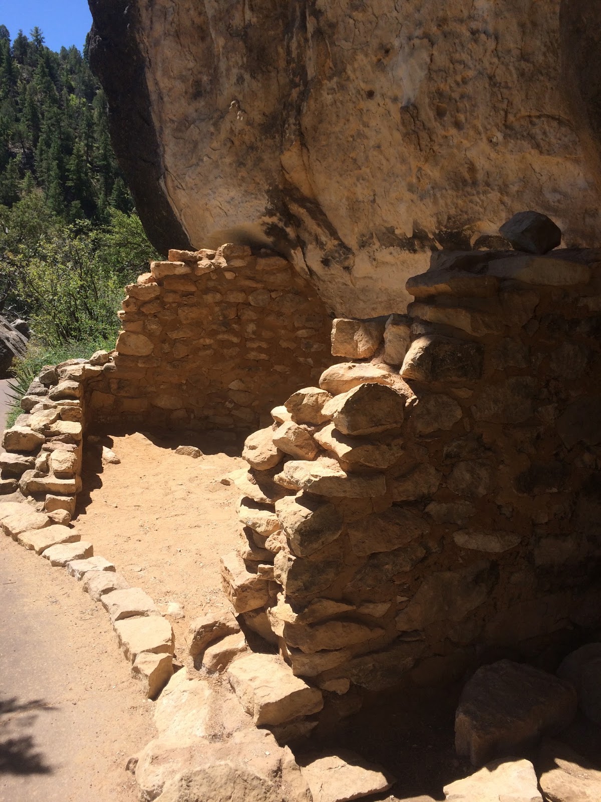
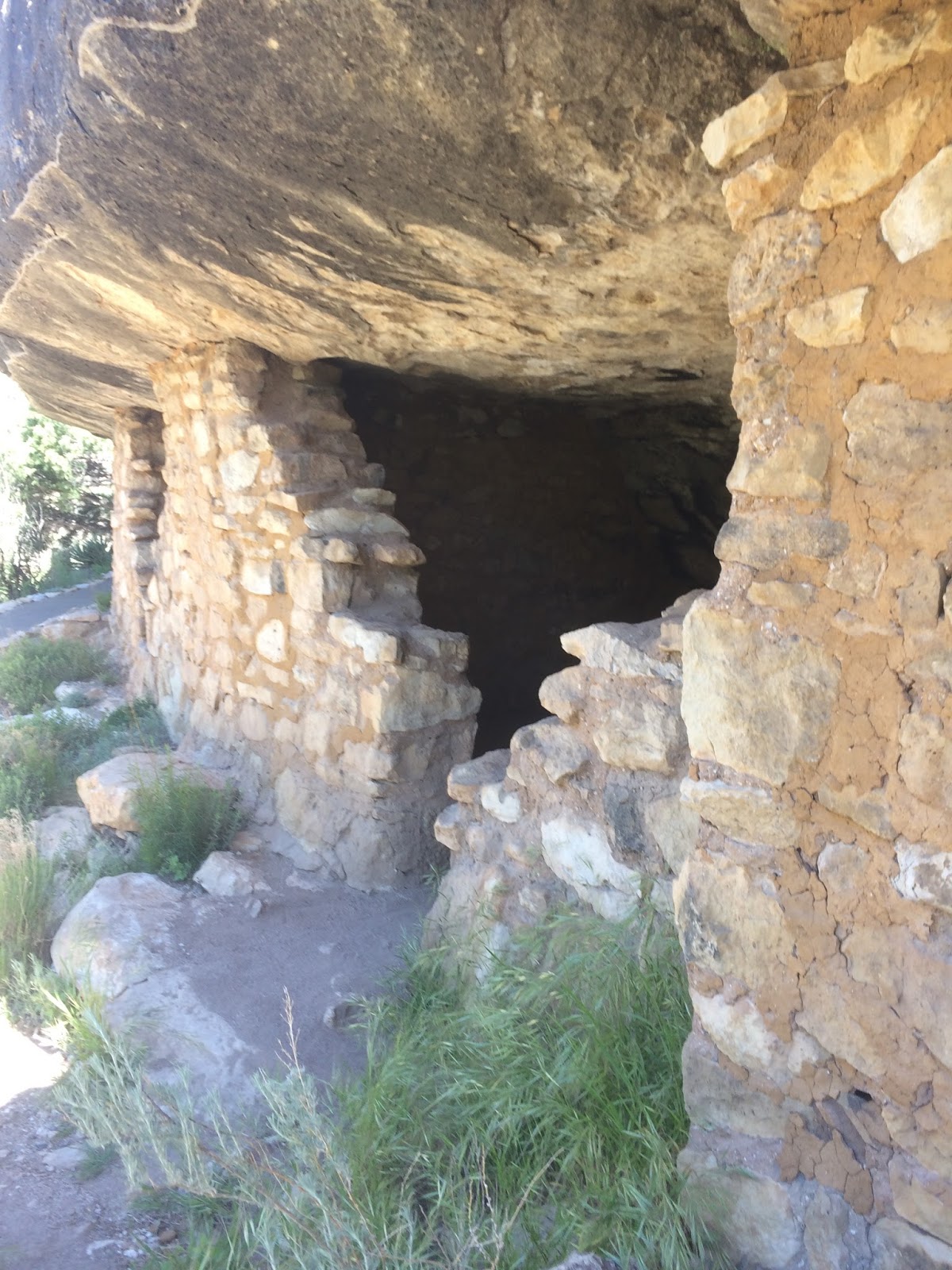
Wupatki National Monument preserves some impressive and thought-provoking pueblos built around and with existing rock and expanded to dwellings, with one of the pueblos comprised of 100 rooms!


One can choose from a number of trails, and there are guided tours as well! If you are hiking on your own, you can pick up a printed guide at the Visitor Center. This printed guide will lead you through the numbered areas of the site and reveal the details of the buildings and the construction.


The attention to detail, the structural integrity and the history of this site are just amazing! This site was a trade hub and a community. Sinagua, Cohonina, Hohokam  and Kayenta tribes cultivated cotton, corn, beans and squash and raised families here. 


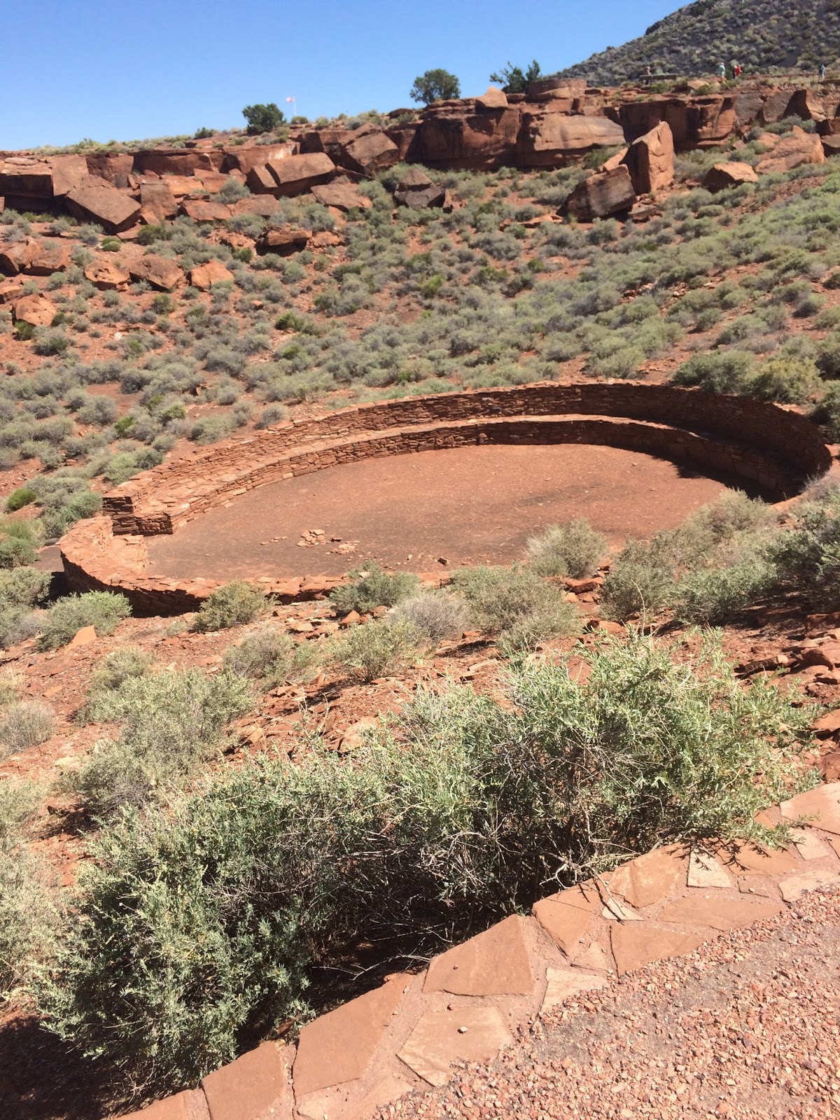
There are many opportunities for hiking. We took these pictures on the hike that begins at the Visitor Center. The hike is not challenging and there are well-marked trails and markers that lead you through the area. 

There is NO shade here. Bring plenty of water, comfortable, sturdy shoes and sunscreen.


Sunset Crater

Yet another hike away from Sedona (we did a lot that day, including Walnut Canyon and Wupatki). Sunset Crater and the surrounding area reveal a large slice of ancient history with volcanic lava fields and hills and valleys that illustrate the massive changes that shaped the earth in this area.


Sunset Crater is a National Monument with plenty of trails (the Aa Flow trail, the Cinder Hills Overlook and the Lava Flow Trail) to satisfy the meek and the more adventurous hikers.

We chose the most strenuous of the hikes within this park: Lenox Hill Trail.


This is a steep 1 mile trail that wanders through the Ponderosa Pines and ends up at the top of the hill with a great view of the San Francisco Peaks.


Be careful while hiking in Sunset Crater Park and stay on the trails to avoid damaging the landscape and avoid injury. Lava is brittle, sharp and unstable!


These 25 year-old hiking boots did the trick for me!


You should plan on spending some time at the Visitor Center before you start your hike to get oriented.


Walnut Canyon

OK, OK, so it isn't technically in Sedona but it is nearly within earshot!  This is a hike we haven't done for 25  years so we decided to head on over to Walnut Canyon and do it again.

The Visitor Center provides some preliminary information and a video to get you oriented. Then you start your descent into the canyon to view the cliff dwellings. Island Trail is not for those with bad knees or a bad lower back. There are a lot of stairs leading down and, of course, you have to get back out again, so beware!

If you have someone in your party who can't make the trip down, you can use the Rim Trail which is suitable for those in wheelchairs and those with strollers.


Walnut Canyon was inhabited from about 600 to 1400 A.D. and this thriving community used this sparse land to grow food and raise families. These cliff dwellings were home to hundreds of people.


The day was beautiful but windy and the local spring blooms were beautiful. The dwellings are still miraculously intact although looting in the 1800s and the early 1900s took its toll. During that time, some walls were knocked down and many artifacts were taken from this site. Its designation as a National Monument now protects it for generations to come. 

If you close your eyes and sit quietly, you can imagine the echoes of families and children calling across the canyon!


The dwellings on the opposite side of the canyon are not accessible but when one considers the placement of these dwellings and the challenge of getting up to the rim for farming and other activities, it is truly a testament to the will and determination of the people to think that they carried on everyday life here for so long. 


If you want to visit Walnut Canyon, plan on spending 3-4 hours at the site so you have plenty of time to see the Visitor Center and to take the trek down and up the canyon. It is well worth the time. Bring plenty of water, good hiking shoes, a hat and some sunscreen. 


Monday, January 30, 2017

Fay Canyon

This is a very popular hike for tourists and residents alike and with good reason. It is a very reasonable length (1 mile in) and there is no real climbing or elevation change.


Park across the street in the lot and cross Dry Creek Road to the trail head, then meander along the dry creek bed and follow the canyon back to the end. It is an easy hike and one that is shaded around noon with some sun on the trail in the afternoon.


At the end of the maintained trail, you can choose to turn back or you can dare to scramble up the red rocks and get a better view at the top. It is rough going but you will be rewarded with some beautiful pictures at the top.


There is an archaeological site at the top so be sure to pay attention to the signage at the end of the maintained trail.

Do not move or throw rocks. Do not carve or paint your name on the rocks. Do not disturb the landscape. Leave the beauty and the rich heritage and history for those who come after you!